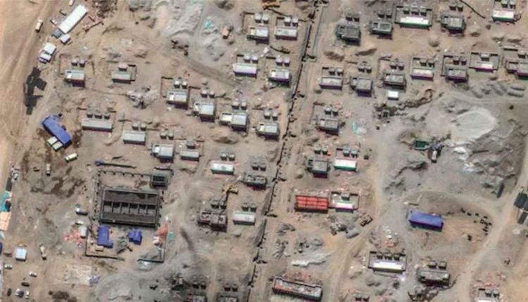
New Delhi: Amid ongoing diplomatic efforts between India and China to de-escalate border tensions, recent satellite imagery has revealed significant construction activity near the northern shore of Pangong Tso Lake, further intensifying concerns along the disputed border.
Satellite images from 9 October 2023, captured by US-based Maxar Technologies, show a sprawling settlement covering approximately 17 hectares. The site, located near the Yemago Road at an altitude of 4,347 metres, appears to be rapidly developing with construction machinery visible.
According to an analysis by India Today, over 100 structures are being erected, including residential buildings and administrative facilities. The presence of flat open spaces suggests potential use for parks or recreational areas, while a large rectangular strip measuring 150 metres is speculated to be prepared for helicopter operations.
Professor V. Nithyanandam, a geospatial research expert from the Takshashila Institution, explained that this settlement features a mix of one- and two-storey buildings, likely housing six to eight people each. The larger structures are presumed to serve administrative or storage purposes. Nithyanandam further noted that the surrounding terrain provides natural cover, making the site difficult to observe with land-based surveillance.
Military sources have indicated that this settlement, if used for military purposes, could serve as an “ad hoc forward base,” reducing China’s response time in case of conflict.
Construction at this site reportedly began in April 2024, and analysts believe it is part of China’s broader strategy to consolidate its position along the Line of Actual Control (LAC). Although diplomatic talks between India and China continue, this development underscores the ongoing military build-up along the disputed border.


Comments are closed.