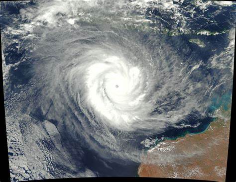
Bhubaneswar: An unusually warm Indian Ocean has paved the way for yet cyclone with the GFS group of models indicating intensification of the depression, which is likely to form over southeast BoB and adjoining Andaman Sea around November 27, into a severe cyclonic storm by the month end.
According to North Indian Ocean Extended Range Outlook for Cyclogenesis issued by the India Meteorological Department (IMD) on November 23, IMD GFS, NCEP GFS, ECMWF and ECMWF ensemble are indicating likely emergence of a cyclonic circulation into South Andaman Sea around November 25 with formation of a low pressure area around November 26 over South Andaman Sea. “These models are also indicating formation of depression over South BoB during November 26-30 (IMD GFS around 26th, NCEP GFS on 27th and ECMWF around 30th but over Southwest BoB). GFS group of models are also indicating further intensification of this system into a severe cyclonic storm,” it said.
MOVEMENT & INTENSIFICATION OF THE SYSTEM
>> GFS of models indicate initial west-northwesrtwards movement till November 28 towards Central BoB followed by north-northeastwards movement towards Bangladesh coast.
>> IMD GPP is indicating a significant potential zone for cyclogenesis during November 26-30, starting from south Andaman Sea with initial west-northwestwards movement till November 28 and then north-northeastwards movement. It is also indicating another cyclonic circulation over South Andaman Sea on November 29, with intensification into a depression over southeast BoB on December 1 and nearly west-northwestwards movement and significant intensification.
The extended range model IMD CFS V2 is also indicating 40-50% probability of cyclogenesis over Andaman Sea and Southeast & adjoining eastcentral BoB and 40-50% probability of cyclogenesis over southeast Arabian Sea during week 1 (November 24-30). During week 2 (December 1-6), 30-40% probability of cyclogenesis is likely over south Andaman Sea and southeast BoB.
>> ECMWF, however, indicating west-northwestwards movement towards westcentral BoB till December 2 and gradual northeastwards recurvature thereafter.
>> NCUM is not indicating any significant cyclonic disturbance over the BoB during the period. However, it is indicating a cyclonic circulation/low pressure area over central parts of South Arabian Sea during November 29 to December 1.
“Hence, high probability is assigned to cyclogenesis over southeast BoB and adjoining Andaman Sea during week 1,” it added.
If the system intensify into a cyclone, it will be called Michaung, a name suggested by Myanmar. It will be the sixth such event forming in the Indian Ocean this year, compared to the customary four cyclones that occur in most years.
“Originating in the Gulf of Thailand, Michaung has been moving towards the Tamil Nadu coast, but may curve towards Bengal, Bangladesh and Myanmar,” RMC director G K Das was quoted as saying by TOI.
On November 17, a low-intensity cyclone named Midhili had crossed Bangladesh coast.
Comments are closed.